geography

Our Montessori Bookshelf: All About Geography!

In Montessori we love to explore how our language shapes our thinking, so we often explore the etymology of words. The word geography comes from the Greek geo, which means earth, and graphein, which means to write. So, geography can be understood as a description of the earth and all that occurs physically upon it. 

Although we name geography as a distinct subject, in Montessori geography is really woven throughout children’s learning experiences. These are some of our favorite books that support what children are experiencing in their geography explorations and that also encourage their natural curiosity about the world.

Click on the titles to link to the book on Goodreads.

Land and Water

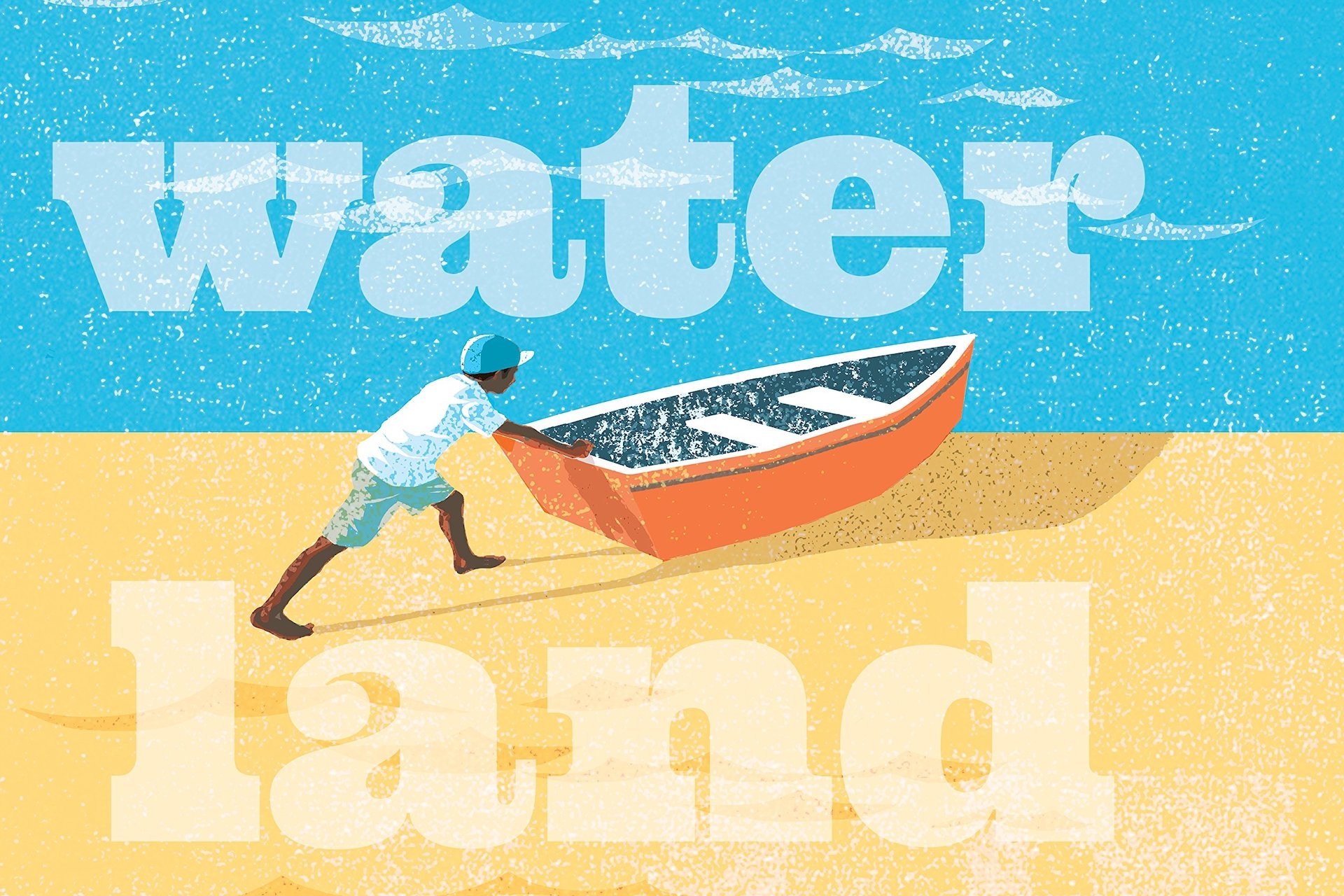
Water Land: Land and Water Forms Around the World
by Christy Hale

This picture book shows the visual relationship between land and water forms by using cut-out portions of the page. Turn the page and a lake becomes an island! The simple yet lovely illustrations of humans interacting with the water and the land are accompanied by one word on each page that states the vocabulary: lake, island, bay, cape, strait, isthmus, etc. This is a perfect book for young children beginning their journey in geography!

Political and Physical Geography

Maps
by Aleksandra Mizielinska and Daniel Mizielinska

This is the perfect tome for children beginning to learn about continents and countries. The sturdy pages give the book a sense of weighty importance, and each page reveals treasures upon treasures. The book offers an overview of the world, then focuses in on each continent and key countries within the continents. Presented in map form, the pages also illustrate animal and plant life, as well as cultural traditions and interesting facts. Both an amazing reference guide and a key to further exploration, this book is rich in visual appeal as well as in content.

Maps of the World's Oceans: An Illustrated Children's Atlas to the Seas and all the Creatures and Plants that Live There
By Enrico Lavagno and Angelo Mojetta

This illustrated atlas combines an enticing visual overview of the world's oceans with easily digestible bits of information about what is found there. Easily a jumping-off point for a slew of research, this book is a must-have resource for any child interested in history, marine biology, or really just cool facts in general.  

Cultural Explorations

This Is How We Do It: One Day in the Lives of Seven Kids from around the World
by Matt Lamothe

Based on seven real children around the world, this book depicts a day in each of their lives. The illustrations and short text of the children’s lives are shown side-by-side, so it’s easy to explore the similarities and differences in how they live: their families, what they wear, their school, what they eat, how they enjoy their evenings, where they sleep, and more. Designed to appeal to a range of ages the book provides large, simple text for each part of the day, as well as short descriptions for more confident readers. Younger children are also fascinated by the pictures of young people engaged in a variety of activities. Best of all, the book offers a delightful reminder of what unites us. 

The Earth

How to Dig a Hole to the Other Side of the World
by Faith McNulty, Illustrated by Marc Simont

Elementary children love this book! The simple illustrations are just enough to spark their imagination as the text takes them on a “what if” journey that starts with finding a soft place to start shoveling. The adventure continues with finding fossils, drilling, perhaps finding oil or a geyser, using a jet-propelled submarine, and eventually resurfacing on the other side of the earth. The best part is that the story perfectly dove-tails with the elementary geography lesson that introduces the layers of the earth. Despite the imaginative aspects of How to Dig a Hole to the Other Side of the World, the book is firmly grounded (pun intended!) in fascinating scientific information presented in just the right way to appeal to elementary-aged children. 

Life Story: The Story of Life on Our Earth from Its Beginning Up to Now
By Virginia Lee Burton

Set as a play, complete with a program detailing the cast and characters, Life Story progresses through scenes from the earth’s beginnings, through the prehistoric eras, to the seasons of human life. This book perfectly illustrates the passage of time and appeals to the elementary-aged child imagining the emergence of the universe and their own place in the story.

Earthshake: Poems from the Ground Up
By Lisa Westberg Peters, Illustrated by Cathie Felstead

These 22 poems offer whimsical yet scientific scenes all about planet earth: from wind to quartz to lava to water. Reading these poems reminds us that we can revel in the love of language while also learning about our world. As a bonus, the endnotes provide a bit more context and information about each of the 22 topics. 

Other Books to Explore

If you and your children are super excited about these titles, here are some other geography books we recommend!
Land and Water: Landforms & Bodies of Water
By Eve Heidi Bine-Stock

Wake Up, World!: A Day in the Life of Children Around the World
By Beatrice Hollyer

Let’s Eat!: What Children Eat Around the World
By Beatrice Hollyer

The Shortest Day: Celebrating the Winter Solstice
By Wendy Pfeffer, Illustrated by Jesse Reisch

Solving the Puzzle Under the Sea: Marie Tharp Maps the Ocean Floor
By Robert Burleigh, Illustrated by Raúl Colón

Ready for the Universe: Geography for the Elementary Age

Montessori work

When children enter a Montessori elementary classroom around age six, they have undergone a great transformation. Whereas they previously wanted and needed to explore their immediate environment on a sensorial level, now they want and need to explore by using their intellect and imagination. 

The study of geography takes on a whole new meaning at this age when children are fascinated by the smallest particles and the largest stars. They want to know why the seasons differ in the Northern and Southern Hemispheres. They are curious about what made the Grand Canyon. They want to know why ocean currents affect the weather.

This desire to know why propels children to discover relationships and functions, not just learn facts. They are also fascinated by the extreme and the outstanding. They are drawn to the very large and the very small. They ask Why? What for? How is this related?

The Universe

Elementary-age children have a consuming interest in everything! To cater to this all-embracing thirst for the reasons of everything, we begin with the universe. One of the earliest lessons we introduce is the story of the universe. From this first story, children are delighted by a myriad of lessons and activities which fall under the general heading of ‘geography.'

Beginning with the universe gives elementary children a big-picture context. In Montessori, rather than encountering bits of disconnected knowledge, children learn about the order and harmony of the universe, as well as the relationships that exist between all things. 

“If the idea of the universe be presented to the child in the right way, it will do more for him than just arouse his interest, for it will create in him admiration and wonder, a feeling loftier than any interest and more satisfying. The child's mind then will become fixed and can work. The knowledge he then acquires is organized and systematic; his intelligence becomes whole and complete because of the vision of the whole that has been presented to him and his interest spreads to all, for all are linked and have their place in the universe on which his mind is centred.”  — Dr. Maria Montessori, To Educate the Human Potential 

Constructing Understanding

Dr. Montessori observed that children around the world tended to ask similar questions at this age. The geography presentations and lessons support these fundamental reoccurring questions. 

Our goal is to help elementary children have an explosion into understanding. However, this kind of understanding does not come from adults explaining everything.

Instead, we give children experiences and just enough information so they can find out more and make associations. When children make their own connections, real and lasting understanding happens. Even better, the children respond with enthusiasm and excitement!

Geography Topics

Children in a Montessori classroom do not encounter subjects grouped under curricular headings. Subjects are integrated because children are building their minds. They are exploring their world, rather than the chapters of a textbook. Although there is a structure in the classroom environment, children have the opportunity to explore different many different aspects of geography including:

  • Space, Earth, and the Universe

  • Composition of the Earth

  • Nature of the Elements

  • Sun and Earth

  • Work of Air

  • Work of Water

  • Life on the Land

  • Interdependencies

  • Economic Geography

The lessons we present, and the resulting children’s explorations, lead into astronomy, physics, chemistry, meteorology, geology, and more. For example, as we look more closely at how the earth revolves around the sun, children learn about solstices and seasons, climatic zones, and flora and fauna found in particular regions.

Aids to Understanding

For each topic, we provide imaginative aids, often in the form of stories, colorful impressive charts, and a variety of experiments. Many of these instructive aids have been selected to provide impressions, not just facts. The aim of our geography presentations is to intrigue the children and spark their imagination. We want them to be inspired to find out more!

We concentrate on giving key information, discussing reasons, and illustrating details, all of which draw children’s attention to certain phenomena. Once interest is there, children want to learn as much as they can. It is as if we are giving elementary students keys to knowledge and understanding. Once they have the keys, they can open doors and continue their explorations.  

Geography is a vibrant aspect of the Montessori elementary and generates spontaneous, active, self-renewing interest! A love of learning blossoms in the children, and many develop a lifelong fascination with elements of geography. We invite you to visit our school and see this love of learning firsthand!

Grasping the World: Geography for Young Children

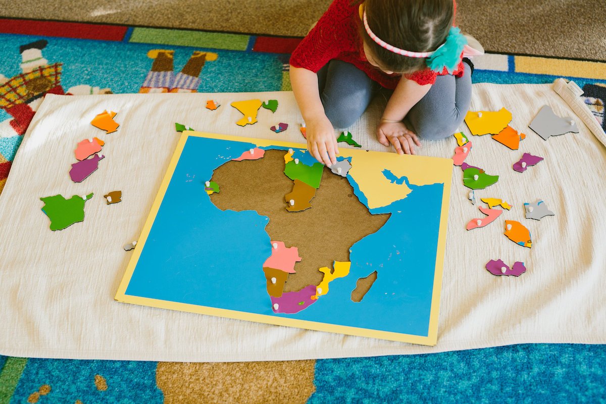
montessori child using puzzle map

Between mass media and family travel, young children are exposed to all sorts of language about their planet. They may hear phrases like “going around the world,” “as the world turns,” or “the other side of the world.” Young children absorb this information yet still need concrete experiences to help make sense of what “the world” even means!

Over 100 years ago, Dr. Maria Montessori observed how younger children were drawn to the globes that older children were using. Through careful observation, Dr. Montessori came to understand how young children crave a concrete understanding of concepts like the world, the earth, and the globe.

Concrete Materials

In Montessori, we offer concrete materials so children can experience accurate representations of these abstract concepts. We start by providing a small globe. The land surfaces are covered with fine sandpaper and the water surfaces are covered with smooth blue paint, so children can tactically explore the distribution of land and water surfaces over planet earth. With the globe, children get to literally grasp the shape of the planet and have a richer understanding of phrases like “going around the world.”

We also have a set of materials so children can learn about different kinds of land and water forms. Children can pour water into beautifully created models of an island, lake, peninsula, gulf, isthmus, strait, cape, bay, archipelago, or system of lakes. The water flows into the water area (painted blue) and moves around the land area (painted brown). As children learn the names of these land and water forms, they also explore folders with photographs of actual land and water forms from around the world. 

Montessori classrooms also have a second globe to show how the land surfaces are divided into continents. Each continent is painted a different color (green for Africa, red for Europe, orange for North America, pink for South America, brown for Oceania, and white for Antarctica). The color coding of the continents stays consistent throughout all the materials, which helps with association and retention.

Once children have grasped this concept of the land and water distinctions on the globe, we show them a flat puzzle map divided by the Eastern and Western hemispheres with each continent (color-coded as above) as a separate puzzle piece. This continent puzzle map gives children the chance to see all of the continents at once as they look on a two-dimensional map. 

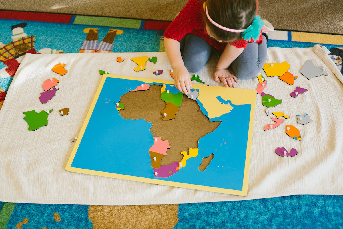
We also offer maps of each continent to show the political partitions formed by countries. Each puzzle piece is a country, with the knob for picking up the piece located at the country’s capital. Children initially use these puzzle maps in a very sensorial way, taking the maps apart and putting them back together. As children engage with this experience, we begin introducing the names of the continents and then the countries. Young children absorb this vocabulary effortlessly and delight in learning the names of all the countries. As children get older, they also enjoy taking on additional challenges, sometimes even closing their eyes, feeling all the way around the puzzle piece, and then naming the country!

Cultivating Appreciation

Although this is all rather impressive, it’s important to remember that our purpose is not to turn children into walking encyclopedias. Even when children may come to rather astonishing intellectual skills, these abilities are a by-product. Our purpose is to offer young children activities to help them understand their place in the world, become aware of the oneness of humanity, and appreciate the incredible variation among people that results from physical geography and humans’ creative efforts and inventions.

To help in this effort, we share collections of pictures of human life organized by continent. These pictures offer impressions of different modern cultures, lifestyles, and traditions. The pictures reflect commonalities of human needs and the great variety of ways humans fulfill these needs. The photographs highlight regional food, farming, shelter, transportation, daily life, traditions, and the physical geography represented in landmarks, climate, flora, and fauna.

As children develop a relationship with the world around them, they may also explore more about the different places in the world, including climates, plants, and animals. Often children love to begin creating their own maps by carefully tracing the puzzle map pieces and coloring and labeling the continents and countries.

In Montessori education, children absorb a great deal of geography skill knowledge! But our focus is on giving children the opportunity to develop a constructive and creative relationship with the whole world, as well as a love for how our planet offers a diverse home to the whole of humanity. Schedule a virtual tour to learn more about this love of geography!

Materials Spotlight: The Puzzle Maps

In this second installment of our new materials spotlight series, we celebrate and explain the Montessori puzzle maps. Beautifully and colorfully painted and carefully crafted out of wood, they can be found in both primary and lower elementary classrooms. While they are used differently in the two environments, educators take a developmentally appropriate approach to utilizing this beautiful geography material.

The Material

In a Montessori classroom, one will find a wooden rack that contains a series of puzzle maps. They are arranged intentionally, starting with the top shelf and working downward:

  1. The planisphere: two blue circles with removable colored continents

  2. A map of the child’s continent: puzzle pieces indicate countries

  3. A map of the child’s country: puzzle pieces indicate states or provinces

  4. Maps of the other continents of the world: pieces indicating countries

There is typically also a set of control maps, or corresponding laminated paper maps that have the pieces drawn to scale and labeled. Children may use these as reference depending upon the activity.

An Introduction

Of course, we begin with the top map of the world. Previously, the child will have worked with the Montessori globes, so they will have some idea about the world, the continents, and the oceans. Using the three-period lesson format, the guide introduces (or reviews) the names of the continents. The guide will demonstrate how to properly retrieve the puzzle, lay it out on a work mat, remove each piece carefully and replace them while naming them. Some classes may have laminated paper labels the child can lay on top of the pieces while they work.

A critical part of the introductory lesson is showing the child how to properly put the puzzle back together and return it to the correct shelf in the rack. Our guides take great care in making sure lessons are not just about the academic skills, but also about how to respect the materials, ensuring they will be in good working order for the next child.

The Work

Once the child has been given the introductory lesson, they may return to this work whenever they like. As with everything else in the Montessori environment, if the child continues to feel drawn to a material, they are still getting something out of the experience. This may appear overly repetitive to our adult eyes, but it’s important that we suspend those judgments and allow the child to trust their instincts.

Once the child has tired of the world map, they are welcome to proceed downward through the others. Their teacher does not necessarily need to give a lesson for each one (although they may, for various reasons); once a child understands how to use the puzzle maps they are free to explore them all.

During the elementary years, we encourage children to use an atlas alongside them while they work. While control maps are useful and serve their purpose, it’s important that they begin to develop their proficiency with a variety of reference tools. When using an atlas, they often need to refer to the table of contents, find the correct page, and look carefully for labels that don’t correspond exactly with the colors and fonts they are used to seeing on the Montessori control maps. This is just one of the many ways we gently guide children toward being able to find answers for themselves.

Extensions

The puzzle maps are such a popular material among children, that it’s only natural we should offer extension work to create more learning experiences for those who are ready and eager. Just a small sampling of the possibilities:

  • Pin punching: In the primary classroom, children may trace continent pieces onto construction paper and use the pin punching tool to perforate each one. They may then adhere them to perforated blue spheres, thereby recreating the map so that they may have a copy to keep.

  • Map making: Giving children large pieces of white paper, they may carefully trace, label, and color each individual piece.

  • Embark on research projects: Children who have enjoyed and mastered the puzzle maps may then choose to read and write about various continents or countries.

  • Continent studies: Some teachers choose one continent each semester to focus on in depth. While the puzzle maps serve as a focal starting point, the study will include exploration of biomes, animals, culture, and more.

What’s Next?

Kids love the puzzle maps, so they often spend years absorbing everything they can from them. Eventually, however, they are ready for more. At some point during the elementary years we introduce the pin maps. These are smaller wooden boards with maps drawn on them, and with three tiny holes drilled into each country: one for the country’s name, flag, and capital city. Corresponding metal pins with labels are available for the child to use as they learn to identify each. Control maps are available for the child’s reference.

As with many other materials, the pin maps are introduced in steps. First, the child will just focus on learning to label each country. Once they have mastered that skill, they will move on to flags, and eventually, the capital cities.


Want to learn more? Interested in observing as children engage with these fascinating geography materials? Let us know!

Montessori Basics: Geography

google ad 2.jpeg

Geography: a science that deals with the description, distribution, and interaction of the diverse physical, biological, and cultural features of the earth's surface

Geography is a commonly taught subject in most schools, with children learning about maps, the globe, and various countries and land features. Montessori schools do this as well, but as with most subjects, we tend to take things a bit deeper (even for our younger students). This article highlights the scope of our geography curriculum.

One point to note: Montessori teaches children beginning with a ‘big picture’ view, while slowly narrowing in on details. We believe this makes information more developmentally appropriate as well as giving children a sense of the interconnectedness of all things. This approach also leads to some overlap with other subject areas, which is a good thing!

Globes, Maps, and Physical Features of the Earth

Geography work starts early in our primary classes. Children begin with an introduction to three different globes; one is blue with sandpaper continents, the next is blue with smooth white continents, and the third is blue with colorful continents. Montessori materials have specific colors designated for each continent: Africa is green, Asia is yellow, Australia is brown, Antarctica is white, South America is pink, North America is orange, and Europe is red. These early globe experiences help give children a sense of the roundness of Earth and the differences between major areas of land and water.

Children then move on to using the puzzle maps; a classic Montessori material. They begin with a map of the continents that utilizes the same colors they learned on the early globe, and then explore puzzles for each continent of the world. There are also more specialized puzzles available, including one of the fifty states, the provinces of Canada, etc. These are first used in the primary class but continue through lower elementary.

The last set of specifically created maps - the pin maps - are used in elementary, and children are encouraged to use an atlas as a control of error while they work. This material incorporates wooden maps with predrilled holes in each country. Children use small label flags that are meant to be inserted into the correct spot.

Also beginning during the primary years and continuing through the early elementary years, children learn about land and water forms. This includes the parts of a mountain, the parts of a river, and the names of a wide variety of land and water formations.

Creation Stories

As part of the science and history curriculum, elementary children are told the creation of the universe story once per year. This important lesson is based on today’s scientific evidence, but we feel it’s important to honor the many other creation stories throughout history. That’s why we also take the time to read tales that span a wide variety of cultures. There are many learning extensions that can be applied, such as discussing the similarities and differences between cultures, having children create artwork to represent the stories, or even having small groups of children act them out.

Laws of Attraction and States of Matter

When we tell children the story of the creation of the universe, we do it with a series of props laid out before them. When we talk about the behavior of particles, we show them a visual example. When we talk about the formation of the planets, we touch upon the three states of matter on Earth. We teach them how temperature and force affect these states, and how ultimately this has an impact on the formation and continuous changing of our planet.

This introduction segues into a series of experiments that children are able to complete independently (after an introduction and safety rules, of course!). Materials for the experiments are set upon the shelves, along with instructions. While most people would consider this science - as it is - we consider it part of our geography curriculum even though this is one of the most obvious points of overlap.

The Sun and the Earth

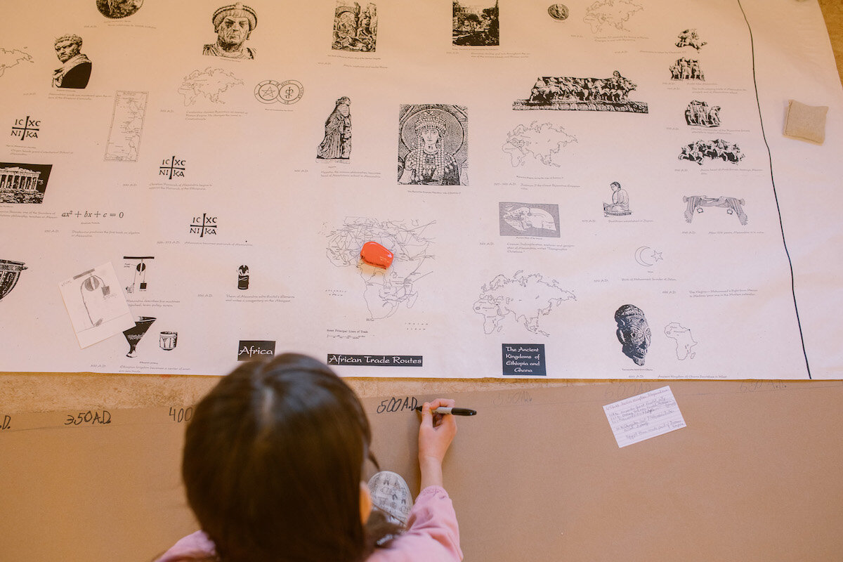
The elementary geography curriculum is complimented by a series of charts that visually illustrate important information. Some are diagrams while others are impressionistic drawings. These charts are particularly helpful when teaching about the sun and the earth.

We start simply, by teaching children about Earth’s orbit around the sun as well as its rotation on its own axis. This leads into many lessons about concepts like day and night, the seasons, the zones of the earth, and even time zones.

A good deal of time is spent teaching children about the composition of the earth. This includes the different layers, but also the formation of mountains, faults, and volcanoes.

The Work of Wind

Wind is a powerful force. We think it’s important to teach children about the behavior of air in our atmosphere and the effects it has on the planet. We cover how temperature affects the movement of air, air pressure, the relationships between winds, seasons and weather, and ocean currents.

The Work of Water

Water, as liquid water or solid ice, has a tremendous impact on our planet. We discuss concepts such as erosion, sediments, the effects of rain, and the effects of ice on the landscape. We also cover water vapor when teaching children about the water cycle on our planet.

Vegetation, People, and Economy

After some basic botany lessons, it can be fascinating for children to learn about the variety of vegetation found in different biomes of the world. This leads into the study of the people in various biomes and how climate can change the way we live. Lastly, we teach children about economic geography; our economies have always been tied, in part, to the variations in resources available in different regions. We encourage children to analyze and question concepts like production and consumption. 

Interested in learning more? We hope you’ll consider reaching out for a tour. This gives families - new and current - an opportunity to learn more about what we do and how we strive to provide children with an education that will guide them for the rest of their lives.


Montessori Basics: The Cultural Subjects

culture.jpeg

Montessori is known for fostering academic excellence. While most people think of how we teach children reading, writing, and mathematics, you might be amazed to learn how we teach other subjects!

In Montessori classrooms (particularly elementary classrooms) the following subjects are referred to as cultural areas of study. They often overlap, as they do in the real world, and guides are adept at weaving language and math work into lessons as well.

It is important to note that while we do have a standardized cultural curriculum, our guides are specially trained to honor and support the personal interests of their students. This means some areas may be studied more deeply than originally intended, or they may end up branching off into other related areas of study in addition to typical lessons and materials. Doing this allows us to continually foster curiosity and internal motivation as young children grow and develop.

Science

When it comes to science in Montessori classrooms, biology is the main event. With work that spans basic biology as well as botany and zoology, we provide authentic points of interest by keeping living things in our environments. Our classrooms are home to both plants and animals, both of which are cared for by the children. When teaching various lessons in biology, guides often utilize living samples to increase interest and engagement.

Children in our primary classrooms begin this work by way of nomenclature. Card materials that double as reading practice help them learn the names of body parts of different animals. For example, one set of cards might include a picture of a horse with label, along with cards highlighting and labeling hoof, mane, tail, eye, ears, etc. Primary-aged children also get plenty of hands-on experience with botany learning; they cut and arrange flowers, they prepare various fruits and vegetables to eat, and many get a chance to garden and/or compost. They also learn the basic parts of plants, as well as the different shapes of leaves.

The learning continues into the elementary years, where students study the kingdoms of life on earth, differentiate between invertebrates and vertebrates, and study the external features and body functions of the five classes of vertebrates. Their understanding of botany expands and deepens, as they learn in greater detail how plants are formed, how they reproduce, and how they interact within their broader ecosystems.

In addition to their work in biology, Montessori students study a wide variety of other subjects in science. They learn about the scientific method, how to conduct experiments, and topics such as the solar system, chemistry, physics, and more. They attend lessons with guides, explore topics independently and with peers, and learn how to conduct research.

Geography

Montessori children learn to view geography as an interesting and multi-faceted area of study. Primary-aged children learn about the continents and biomes of the world using specialized globes, wooden puzzle maps, and other materials. During the elementary years this work is expanded significantly. Children learn about the different countries around the world, the cultures of the people who live there, and the animals who inhabit the various biomes. They also learn about landforms and bodies of water.

Beyond the surface of our earth today, our students learn about how it has changed over time. They are taught about the beginnings of our universe and how our planet was formed. They learn about the layers of our atmosphere and the layers of the earth itself. They explore the mechanics and functions of various natural occurrences around the planet, including how water (in all three states of matter) and wind can contribute to significant change over time.

Our hope is to give children a view of the whole world, and our work in geography serves as an impressionistic platform to inform them of the interconnectedness of everything on our planet.

History

While the bulk of the history curriculum begins in the elementary years, primary children often have an opportunity to reflect on their own lives during our traditional birthday celebrations, as well as gaining an initial sense of the passing of time. They learn about the days of the week, the months of the year, and start to use a calendar together as a group.

Beginning in the first grade, we know that children are developmentally ready (and eager) to explore the concepts of history. As mentioned in our summary of the geography curriculum, we give our students a look at the history of our universe. This leads to a study of the evolution of organisms on Earth, as well as a look at early humans.

Our study of the history of humans branches off into many directions. After learning about the earliest humans, children learn about ancient cultures, the fundamental needs of humans, and how people in different societies have (and continue to) meet those needs. We explore the origins and history of mathematics and language, which children at the elementary level find particularly relevant and interesting.

Perhaps unsurprisingly, these three subjects tend to overlap and connect quite a bit. Sometimes we guide children to discover these connections, and other times they recognize connections on their own.

Want to learn more? We believe the best way to discover Montessori education (or just to expand your understanding) is to visit our school. We welcome you to schedule a virtual tour. Today, we leave you with a quote from Dr. Montessori’s book, To Educate the Human Potential:

"…to give the whole of modern culture has become an impossibility and so a need arises for a special method, whereby all factors of culture may be introduced to the six-year-old; not in a syllabus to be imposed on him, or with exactitude of detail, but in the broadcasting of the maximum number of seeds of interest.  These will be held lightly in the mind, but will be capable of later germination, as the will becomes more directive, and thus he may become an individual suited to these expansive times."